THANK YOU FOR SUBSCRIBING
Be first to read the latest tech news, Industry Leader's Insights, and CIO interviews of medium and large enterprises exclusively from Gov CIO Outlook
THANK YOU FOR SUBSCRIBING

By
Government CIO Outlook | Thursday, December 17, 2020
Stay ahead of the industry with exclusive feature stories on the top companies, expert insights and the latest news delivered straight to your inbox. Subscribe today.
Synspective's Flood Damage Assessment Solution offers damage information when a flood occurs, using the highly reliable SAR-attributable data abilities.
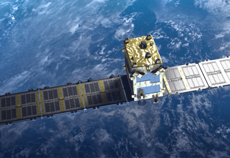
FREMONT, CA: Synspective, a Japanese company delivering satellite data and derived solutions, using small-sized SAR (Synthetic Aperture Radar) satellites, rolls out its SAR-based "Flood Damage Assessment Solution" service, which offers damage information when a flood occurs, using the highly reliable SAR-attributable data abilities of all-weather, any time, high-frequency observation.
The Flood Damage Assessment Solution is a service that examines inundation damage (inundation area, inundation depth, damaged roads, damaged buildings) as a measure during a disaster response. In the event of a disaster, significantly when affecting large areas, early data and fast action are vital. SAR satellites are potent of all-weather, anytime, ground observation, as such, when a flood happens, it is possible to rapidly grasp the gravity of the situation and assess the damage without delays. Furthermore, by leveraging cutting-edge AI methods, the tool can also find the level of impact on facilities, like roads and buildings, in a fast manner.
In the occurrence of a flood, insurance, financial, and government agencies have a proven need to assess damage based on early information quickly. Synspective's Flood Damage Assessment Solution provides stable, high-frequency data from SAR satellites, using cutting-edge AI methods to provide critical information. Synspective delivers this solution on a subscription basis through a SaaS (solution as a service) format. User-friendly UI/UX allows users to intuitively understand the analytics outcomes without any prior experience of satellite data needed.
As a solution that uses satellite imagery, combined with flood depth information from other existing datasets and real-time data sources, Synspective's tool was selected as one of the four finalists in the UR2020 conference on risk management.
Synspective provides one-stop-solutions by satellite gathered geospatial data. The core technology was developed by the ImPACT program led by The Cabinet Office, building small SAR satellites and constellations, enabling frequent observation of areas of interest (AOI). Synspective uses its satellites to produce SAR data which can be delivered to both government and commercial clients as-is, and transform that data through AI solutions to create insights and user-friendly information across industries.
I agree We use cookies on this website to enhance your user experience. By clicking any link on this page you are giving your consent for us to set cookies. More info


